
Open User Map
Open User Map lets you create an interactive WordPress map where visitors can add and edit locations with your approval.
Visit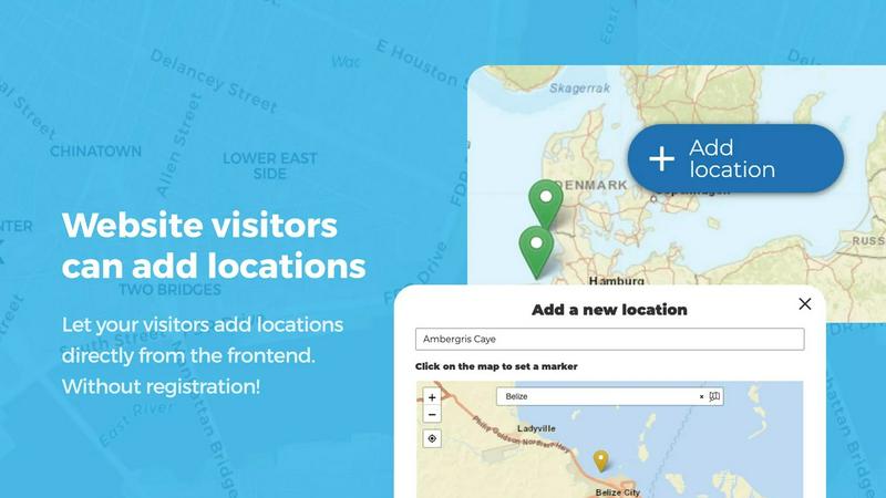
About Open User Map
Open User Map is a WordPress plugin that turns your website into an interactive, community-driven mapping platform. At its core, this tool allows you to create a map that your visitors can contribute to directly from the frontend of your site. Think of it as a way to crowdsource location data without needing any coding skills, a Google Maps API key, or complex setup procedures. The plugin handles everything from user submissions to approval workflows, giving you full control over what appears on your map.
The main value proposition of Open User Map is its simplicity and accessibility. You can install it on your WordPress site and have a fully functional interactive map running in minutes. Visitors can add new locations, edit existing ones, and interact with the map through features like upvotes, likes, and star ratings. Behind the scenes, you have powerful customization options including custom fields, categories with unique icons, and the ability to draw lines and areas. The plugin is designed for anyone who needs a map that grows with community input. This includes tourism boards, local business directories, event organizers, real estate agents, campus administrators, and community groups. With over 15,000 active installs and a 100% five-star rating on WordPress.org, Open User Map has proven itself as a reliable and user-friendly solution for interactive mapping. It ranks as the number two map plugin on WordPress.org, which speaks to its quality and popularity among users.
Features of Open User Map
Frontend Location Submissions and Editing
This feature enables your website visitors to add and edit locations directly on the map from the frontend of your site. When a user clicks the Add Location button, they can place a marker on the map and submit details such as a name, description, and custom fields. These submissions do not go live immediately. Instead, they enter an approval workflow where you can review and approve them before they become visible to others. The editing capability allows users to update their own existing locations, which keeps the map current and accurate without requiring manual updates from you.
Marker Categories and Filtering
You can organize your map by grouping locations into marker categories, each with its own unique icon. This makes the map visually clear and easy to navigate. Visitors can filter the map to show only specific types of locations, such as restaurants, parks, or historical sites. A key advantage is that each location can belong to multiple categories. For example, a coffee shop could be categorized as both a Cafe and a Free Wi-Fi Spot. This flexibility ensures that all relevant attributes of a location are represented and easily discoverable through the filter interface.
Lines and Areas
This feature goes beyond simple point markers by allowing you to draw routes, paths, zones, and regions directly on your map. You can highlight hiking trails, service areas, event grounds, neighborhoods, construction zones, or any custom shape that helps visitors understand your map at a glance. Distances and area sizes are calculated automatically, so routes and polygons include helpful measurements right out of the box. This is particularly useful for maps that need to show boundaries or pathways in addition to individual locations.
Custom Image as Map
This feature lets you upload any image and transform it into a fully interactive map. Instead of using a traditional geographic map, you can use an overlay, floor plan, event layout, game map, product diagram, campus guide, or seating chart. Users can place markers directly on top of this image with the same powerful functionality as a traditional map. You can still add locations, display custom fields, enable filtering, and create an engaging, clickable experience tailored exactly to your specific use case. This opens up possibilities for maps that are not tied to real-world geography.
Use Cases of Open User Map
Local Business Directory
A city tourism board or local chamber of commerce can use Open User Map to create a community-driven directory of local businesses. Visitors can add their own favorite shops, restaurants, and services to the map. The approval workflow ensures that only legitimate businesses appear. Custom fields can capture details like hours of operation, phone numbers, and website links. The star rating and upvote features help highlight the best places, making the map a trusted resource for both residents and tourists.
Event and Festival Planning
Event organizers can use the plugin to create an interactive map of an event venue, festival grounds, or conference center. The Lines and Areas feature is perfect for marking stages, vendor booths, restrooms, and parking zones. Attendees can add their own points of interest, such as meetup spots or favorite food stalls. The Custom Image as Map feature allows you to upload a detailed floor plan or aerial view of the venue, giving attendees a precise and easy-to-navigate map for the entire event.
Real Estate Listings
Real estate agents and property managers can use Open User Map to display available properties in a specific area. Each property can be a marker with custom fields for price, number of bedrooms, square footage, and listing status. Visitors can filter by property type or price range. The map becomes an intuitive way for potential buyers to explore neighborhoods and find homes that match their criteria. The frontend submission feature also allows other agents or homeowners to add their own listings for approval.
Community Resource Map
Nonprofit organizations and community groups can create a map of local resources such as food banks, health clinics, shelters, and community centers. Visitors can contribute by adding new resources or updating information on existing ones. The approval workflow ensures accuracy and prevents spam. Custom fields can include details like hours of operation, contact information, and eligibility requirements. The upvote feature can help identify the most frequently used or highly recommended resources in the community.
Frequently Asked Questions
Do I need a Google Maps API key to use Open User Map?
No, you do not need a Google Maps API key to use Open User Map. The plugin works with its own mapping system, which eliminates the complexity and cost associated with obtaining and managing API keys. This makes setup much simpler and more affordable for website owners.
Can visitors add locations without logging in?
Yes, visitors can add and edit locations directly from the frontend of your website without needing to log in. However, all submissions go through an approval workflow that you control. This means you can review each submission before it becomes visible on the map, ensuring quality and preventing spam or inappropriate content.
Is it possible to customize the marker icons and map colors?
Yes, Open User Map offers powerful customization options for markers and map appearance. You can group locations into categories, each with its own unique icon. You can also customize the overall look and feel of the map to match your website's branding. The plugin provides a range of settings to adjust colors, styles, and marker designs.
What happens after the 7-day PRO trial ends?
The 7-day PRO trial does not automatically turn into a paid subscription. When the trial ends, your access to PRO features will simply stop. You will not be charged anything unless you choose to purchase a PRO license. This allows you to test all features risk-free and decide if the PRO version is right for your needs.
Pricing of Open User Map
Open User Map offers a free version available on WordPress.org and a PRO version with additional features. The PRO version includes features such as Lines and Areas, Custom Image as Map, Advanced Filter Interface, Upvotes and Likes, Star Ratings, Opening Hours, and Regions. You can start a 7-day free trial of the PRO version with no credit card required. After the trial, you can purchase a PRO license to continue using the advanced features. Specific pricing tiers and costs are available on the Open User Map website.
Similar to Open User Map

Unifyca gives you one central place to manage, audit, and backup every agency WordPress site.

A collection of ready-to-use React and Tailwind UI components built with Shadcn to help you build web apps faster.

Webleadr helps you effortlessly find and contact web design leads, including businesses without websites, in just a few clicks from anywhere.

Idearium builds memorable websites that help your business grow online.

Effortlessly host and share any file with instant links, secure storage, and built-in viewers for a seamless experience.

CrawlKit simplifies data extraction by turning any website into a structured API with a single request.

Discover and compare top SaaS boilerplates to launch your app faster with the right features and tech stack.

Shadcn UI Kit provides ready-to-use admin dashboards and templates to accelerate your web development projects.